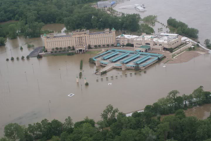
I cant imagine what it will look like when it finally crest!

marshman wrote:Can someone explain or put up a link to a site that would show what would be covered if the MS river levee was not there? I'm at 116ft and was curious what a crest of 64.5ft on the Greenville gage would cover if levees weren't there.
I heard today that the levees in Tensas will be able to handle it. I have always heard the one of weakest spots in the 5th levee district was at Davis Landing near Newellton, but they aren't having any sand boil problems there yet.hntrpat1 wrote:Right that's what I heard and that the levee up by waterproof and St Joe will only hold to 63. The schools plan is to get out a week early and if we do get a mandatory evacuation we are taking all students to Harrisonburg by bus. We have to ride the bus too
Wingman wrote:Gauge 0 at greenville is 74.92' above sea level. At 60 feet on the gauge, everything under 134.92' would be flooded. Belzoni would be under 22' of water; Indianola about 12, Carter about 31.
Bet they have seen the water and people come and go before.Wingman wrote:I saw 7 trackhoes today working on Simmons' catfish ponds. Raising the outside levees. Dirt buckets across the road building a levee around the plant and trackhoes building levees around houses across the lake. Eighteen wheeler trailers backed up to many 6 digit houses built too low for even a normal flood. People moving out and taking all of their jet skis, boats, atvs, etc with them.
Then just down the road in an old, green, cypress house was an elderly black couple sitting on the porch looking across the rising Wolf Lake, enjoying the sunshine. Their house is probably the only one that won't get water as it is on a knoll probably 2 feet higher than the high lakeside ridge they live on. I stopped and talked to them and their concern was the road going under.
There is some benefit to the simple life.
Wingman wrote:Then just down the road in an old, green, cypress house was an elderly black couple sitting on the porch looking across the rising Wolf Lake, enjoying the sunshine. Their house is probably the only one that won't get water as it is on a knoll probably 2 feet higher than the high lakeside ridge they live on. I stopped and talked to them and their concern was the road going under.
There is some benefit to the simple life.
But wouldn't the level be lower as the water was able to spread out instead of being constrained inside the levees?Wingman wrote:Gauge 0 at greenville is 74.92' above sea level. At 60 feet on the gauge, everything under 134.92' would be flooded. Belzoni would be under 22' of water; Indianola about 12, Carter about 31.

Bubba definitely has the equip to do that.. didn't he do a bunch of COE work a few years ago on the levees??Wingman wrote:I saw 7 trackhoes today working on Simmons' catfish ponds. Raising the outside levees. Dirt buckets across the road building a levee around the plant and trackhoes building levees around houses across the lake. Eighteen wheeler trailers backed up to many 6 digit houses built too low for even a normal flood. People moving out and taking all of their jet skis, boats, atvs, etc with them.
There is some benefit to the simple life.
Users browsing this forum: Amazon [Bot], Bing [Bot] and 1 guest